Mighty Himalaya
The entire Himalayan system is a complex of thrust and fold mountain chain. It comprises of the Trans-Himalaya (north of Indus Suture zone (ISZ)); the suture zone; the Tethyan Himalaya; the Higher Himalaya, the lesser Himalaya and the Siwalik ranges showing an average relief of ~6 kms. The Himalaya provides an excellent laboratory to understand: (i) thrust and fold belt tectonics; (ii) mountain-climate interactions; (iii) Glaciers and glacial landscapes; (iv) palaeoglacial deposits and karst topography; (v) river systems; (vi) glacial lakes, meadows and tropical to alpine vegetation diversity; (vii) dendro-climatology and many more. This region offers troves of valuable data on natural hazards like floods, landslides, earthquakes etc.
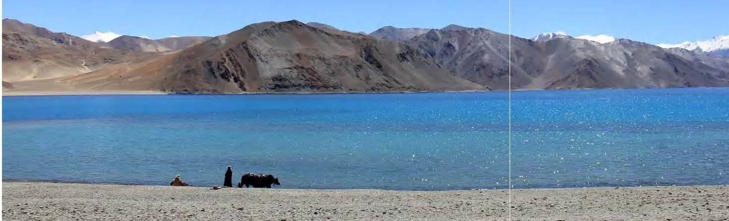
The entire region of Ladakh and Kashmir Himalaya in the rain shadow of the SW Monsoon has an arid to hyper arid climate with steppe vegetation. The region is drained by the Indus River and its tributaries having glaciers in their headwaters. The river banks are flanked by fill and bedrock terraces, large fans, sand ramps, palaeolakes sequences. There are evidences of past occurrences of extreme floods as well. The terraces, palaeolake and sand ramp sequences in the region provide clues towards landscape response to climate variability and suture zone tectonics. The periglacial regions preserve the evidences of past glacial advances in series of well dated moraines. Himalaya houses some of the world’s highest passes - Khardung La (La=mountain pass) at an altitude of 5,359 m connects the Indus river valley to the Shyok river valley. The others being Chang La, Tang La, Zozi La, Fotu La, Pensi ILa, Kumjum La, Nathu La etc., connecting different valleys in the Himalayan regions.
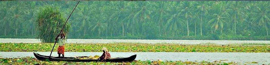
The southern front of Himalaya is influenced by full spectrum of Indian summer monsoon and the rivers draining the region cut all the structural discontinuities orthogonally. These rivers originate from the active mountain belts and cross several thrust sheets characterized by different uplift rates. This leads to different shapes of river long profiles and significant spatial variability in-channel slope. These rivers receive water from different sources namely glaciers, rainfall and groundwater marked by spatio-temporal variability. Sediment supply is also quite variable and sediments are generated from different litho-tectonic units of the Himalaya. Spatio-temporal variability in erosion processes is governed by relief, lithology, rainfall gradient, landuse-landcover and glacial contributions. The region presents a multifaceted interface between the climate-thrust tectonic and landscape evolution. There are chronologically well constrained records of widespread valley aggradation and river incision that are modulated by climate change over the past 100 ka. The studies have also tested various models of neotectonic evolution of collisional mountains.Juniperus polycarpos ) has been found to be the longest living tree in India extending >2 ka and still growing healthy. The tree ring series from semi-arid to arid regions contain strong signatures of temporal variability in precipitation.
The Indian Foreland Basin:
The frontal part of Himalayan thrust fold belt makes a flexural asymmetrical basin called as the Indus-Ganga Brahmaputra peripheral Foreland basin. This basin is bounded in the north by a rising mountain (Himalaya) and deformed foreland deposits and in south lies a subdued fore bulge. The west is bound by Delhi Aravalli Ridge and east by Rajmahal hills.
Indus-Ganga-Saraswati basins
Brahmaputra Plains
The Indian Peninsula
This triangular peninsula, surrounded by Arabian Sea on the west, Bay of Bengal on the east and Indian Ocean on the south, is the region of relative tectonic stability, riverine landscape and deposits and has provided longer records of the past.
Central Narmada Valley Homo erectus , archaic H. sapiens , or H. heidelbergensis by different investigators. Its maximum age is estimated to be >236 ka but not older than the early middle Pleistocene. The alluvial archives of the central Narmada Valley are also well known for their middle Palaeolithic and Acheulian tools.
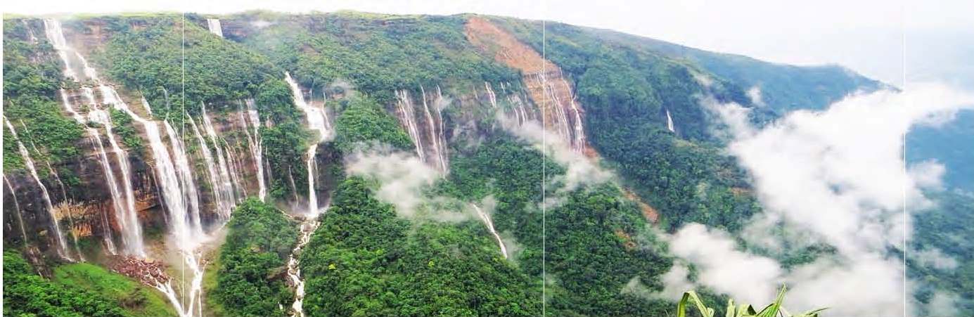
Meghalayan Age Cave
Lonar Crater
Southern highlands and lakes
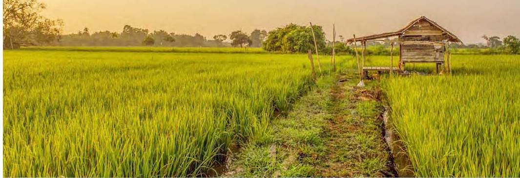
The Core Monsoon Zone
The Arid West
Thar Desert
The Great Rann of Kachchh Dholavira ’ is situated on Khadir Island of the GRK Basin. GRK provided marine waterways / tradeways to Harappans for a long time. Artifacts include terracotta pottery, beads, gold and copper ornaments, seals, fish hooks, animal figurines, tools, urns, and some imported vessels that indicate trade links with lands as far away as Mesopotamia along with 10 large stone inscriptions, carved in Indus Valley script, perhaps the world’s earliest signboard.
The Indian shoreline
India flaunts a more than 7500 km long coastline fringing the peninsula. The Indian coastline falls in humid (having two monsoons), semi-arid and arid climate with rocky, muddy and sandy segments. The coastal wetlands sustain millions of people and are more vulnerable to the effects of rise in Relative Sea Level and changes in marine ecosystems. The sediment depositional environments vary from fluvial, fluvio-marine to purely marine depending upon the geomorphology and distance from the shoreline. The deltaic dynamism is largely influenced by monsoon driven active channels, tectonic nature of the basin, sea level changes, relief of the drainage basin and climate. The temporal and spatial change in these deltaic variables brings about profound alterations in the geomorphology either through erosion or accretion processes. Land subsidence in modern coastal or deltaic plains is a common and is susceptible to sea invasion. The rate of sediment deposition and texture in the coastal wetlands largely varies from time to time and depends on the direction and energy of the rivers/streams which feed them, coupled with the magnitude of wave action. 43% of 1030-km long Andhra Pradesh coastline is under very high risk if the sea level rises by 0.6 m resulting in an estimated loss of _1.2 million people residing within an elevation of 2.0 m.
The East Coast The East Coast is characterized by gentle slope gradient of _1–2 m above mean sea level covering more than 4–6 km from the present shoreline. About 2–3 km of coastal zone is shallow, ranging from 0.4 to 1 m amsl, and is at a very high risk of inundation even if a slight rise in sea level occurs in future either because of climate or geomorphological changes.
Deltas are the most productive landforms along the river topography and are incredibly important to the human geography of a region being most densely populated areas in the world. In Indian subcontinent, most of the major rivers, such as Ganga and Brahmaputra, Kaveri, Krishna, Godavari and Mahanadi flow eastwards and empty into the Bay of Bengal via deltas. The Ganga-Brahmaputra Delta is the largest delta in the world. The Sunderbans, comprising of four UNESCO World Heritage Sites, covers the southernmost part of this delta.
Mangroves play an important role in understanding the extent, magnitude and duration of sea level changes either induced by climate or geomorphology of the area. Mangrove diversity is highest in the East Coast (91.6% of the total mangroves) favoured by the numerous rivers feeding the estuaries/ lagoons. Shallow protected intertidal zones of bay islands such as Lakshadweep and Andaman constitute 16% of the total mangroves.
Sunderbans is the largest mangrove forest in the world, covering an area about 9,600 km2 in India. This area is known to serve as a marine habitat for sea turtles, saltwater crocodiles and other reptiles. The overall subsidence of _1.3-2.2 cm/yr is observed in Sundarbans, because of which an estimated rise in relative sea level is 2.3 cm/yr versus the global estimates of subsidence rates and a rise in sea level are 3.4 mm/yr and 1.7 to 3 mm/yr, respectively.
Bhittarkanika is the second largest mangrove ecosystem of India, next to Sundarbans mangroves. It covers an area of 650 km2 and harbours one of India’s largest populations of saltwater crocodiles Crocodylus porosus. Subarnarekha mangroves, Mahanadi, Godavari and Krishna deltas, Pichavaram and Cauvery estuaries are deltaic mangrove forest situated at the mouth of major rivers carrying freshwater facing Bay of Bengal. Cochin estuary, Coondapur/Malpe area, Zuary estuary, Bombay mangrove creeks, Gulf of Kutch and Bhavnagar estuary, are coastal mangrove habitats in the intertidal zones along with mouths of minor rivers or minor estuaries and back waters facing Arabian Sea. Chilka Lagoon is the largest brackish water lagoon in Asia and stretches over an area of 1100 km. It is a paradise for birding, biodiversity hotspot and largest habitat of Irrawaddy Dolphins.
West Coast
The Islands of India
Andaman and Nicobar Islands in the Bay of Bengal in east is an island archipelago with diverse and encompass unique habitats and complex ecosystems. An area of 513.70 km2 along the West Coast of South Andaman Island is notified as a tribal reserve for the Jarawa people. To the south west of South Andaman Island is North Sentinel Island with an area of 59. 67 km2 and is inhabited by the Sentinalese people. An area of 885 km2 includes the Nicobar Biosphere Reserve and all these parks are within the tribal area. These parks are unique, very diverse and are important biodiversity hot spots, besides being the last remaining 12 pristine areas in the archipelago. Some of these national parks needs to be recognized as world Heritage sites and some should come under the Ramsar Wetlands.
.jpg)